Mason Creek Project Report, Nov 7, 2026

— by Katherine Uitz

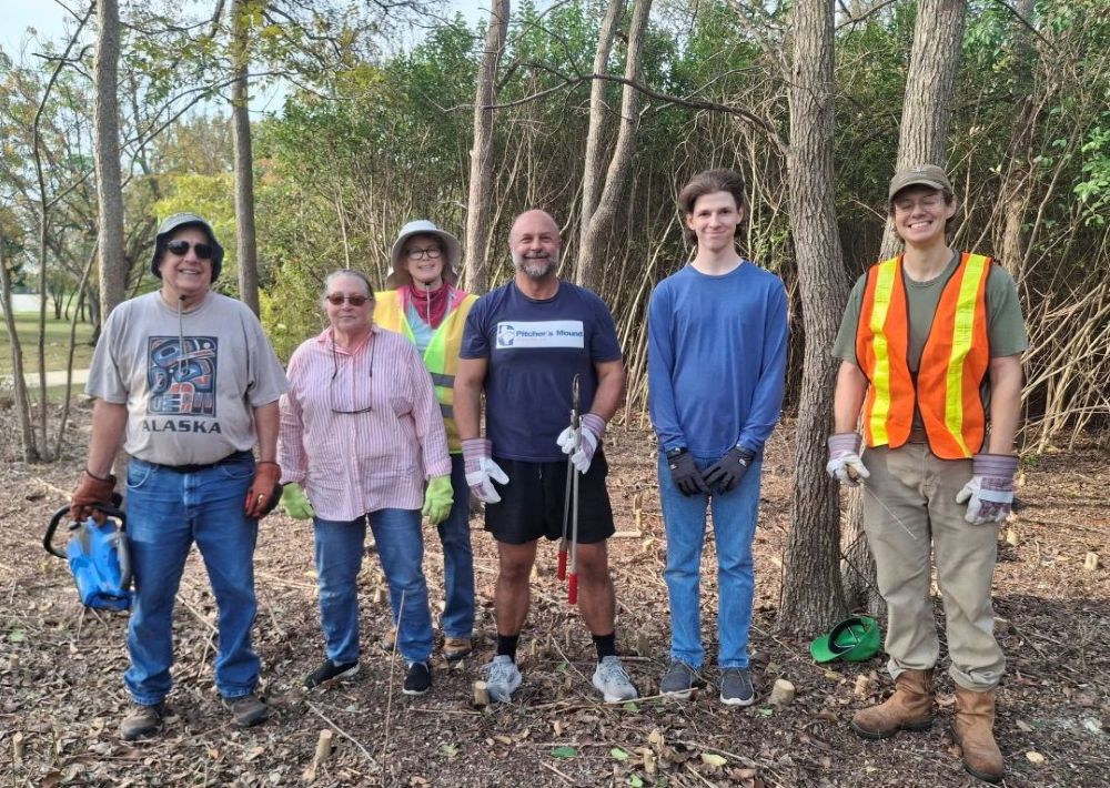
group of people

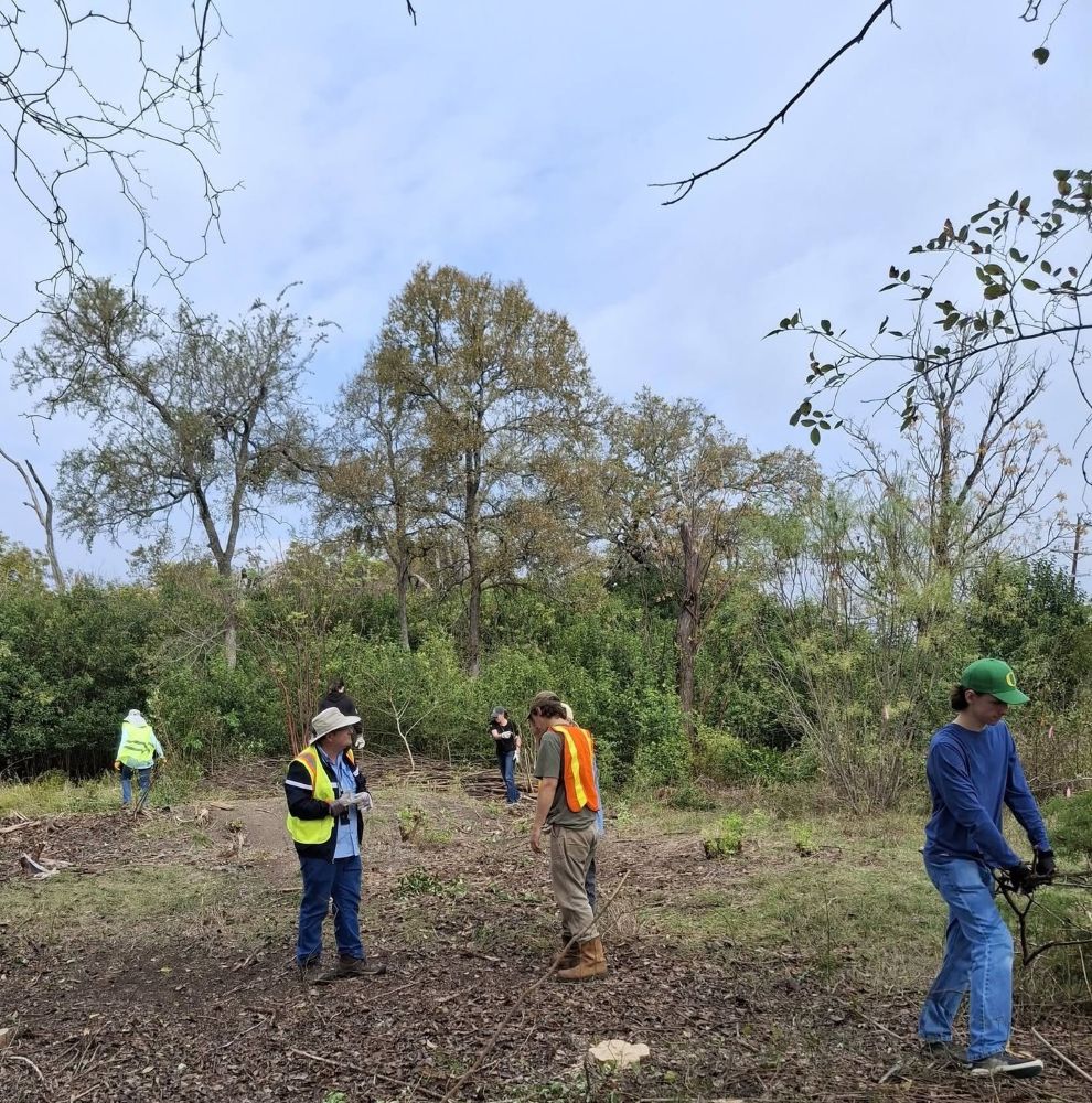
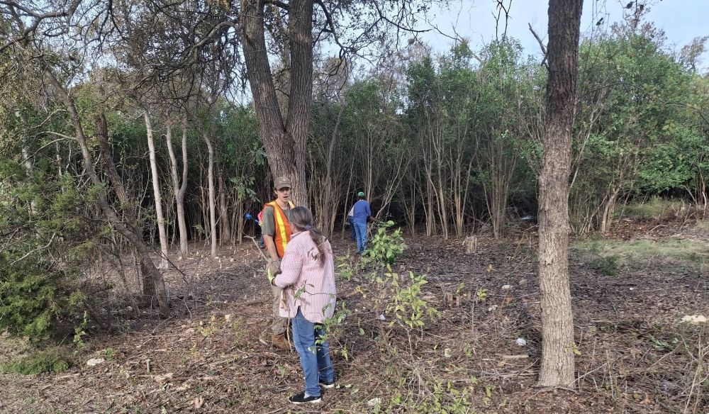
The second Mason Creek Trail Invasives Pull event, which took place on November 7, saw volunteers making huge strides in removing the wall of ligustrums between the trail and the creek. Three more cedar elm trees were freed from their overcrowded conditions and given the gift of light and space to spread their branches. The creek is now visible through the remaining ligustrums along with a pair of very old cedar elm trees.

Volunteers worked tirelessly for four hours, buoyed by the cool weather, the breakfast tacos contributed by Nathaniel Woodward and excitement for the project (and, yes, excitement about having a good excuse to use power tools).

The city of Leander set up dumpsters and brought in public works employees to assist the volunteers in moving the brush into the dumpsters. Leander City council member Annette Sponseller and community advocate Matt Pitcher were amongst the volunteers. Special thanks goes to Leander Water Conservation Program Director, Bill Teeter, and Public Works Director, Michael Riley who are key movers and shakers in making this project happen.

The next two pull events are planned for December and January – dates to be announced. We will certainly see the creek and those two lovely old trees opened up in time for the holidays.

(Mason Creek Trail runs from South West Drive through to Bagdad Road in Leander. Mason Creek is a spring-fed creek that runs cold and clear even in the hottest summer months.)
Recording available for November 12’s โ€œThe Soils of Central Texas”ย with Nathaniel Woodward

The recording from the November 12, 2026, chapter meeting is now available on our YouTube channel. Nathaniel’s presentation begins at 07:17 into the video, after a short business meeting.

You can access the slides and Nathaniel’s soil application at the urls shown below:

  • Nathaniel’s presentation slides
    • (Tip: Use the three-line โ€œhamburgerโ€ menu in the lower left corner on the first slide; select Tools, then select Scroll View Mode.)
  • Nathanielโ€™s app Central Texas Soil Explorer
    • (Tip: See the video and the slides for a tool overview & demo.)

See more recorded topics on our YouTube channel.
Like and Subscribe!


Our page Prior Guest Speakers lists past meeting topics by year.

Business slides for recent chapter meetings are here, listed by date. (If this particular meetingโ€™s business slides were not added yet, they will be soon. Please check back later.)

NPSOT-Williamson County meetings are free and open to the public. We hope you attend!  Meetings may be in person, virtual, or both, so be sure to check details in the meeting announcement. Meetings are announced on our website, our calendar and Facebook.

Field Trip: โ€œWalk Off the Turkeyโ€ @ Garey Park (updated)

— Vicky Husband

  • What:    Annual After Thanksgiving โ€œWalk Off the Turkeyโ€ Field Trip
  • When:   Sunday, November 29, 2026, from 1:30pm-4:00pm
  • Where:  Garey Park, 6450 Ranch to Market Rd 2243, Georgetown, TX 78628 (aka Leander Road)
    • The park is 6.3 miles west of IH35. The “signed” park entrance will be on the north side of the street. Hint: Look for the large City of Georgetown water tower in the area. 
    • See details below about how to check in and where to meet!

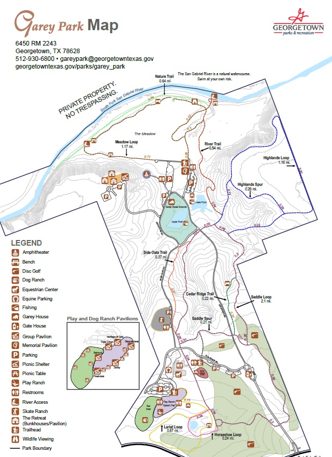
We plan to walk the level and maintained Meadow Loop Trail, the uneven and rocky somewhat-damp edge of the San Gabriel River, and visit the constructed Bluebird Boxes and Wildlife Blind.  Please bring your own water, sunscreen, bug spray, hat, walking stick, and dress for the weather.  Restrooms are available at the starting point.  We will be following “leave no trace” guidelines. 

RSVP not required… Guests of all ages, friends, family, and leashed pets are invited.

CHANGE IN PLANS PENDING AN UPDATE Entrance Kiosk: Check in at the kiosk to pay your entry fee. City of Georgetown residents $2 per person; non-city residents $5 per person. The park is open until 6pm. (11/16: If the plans for how to check-in change, this post will be updated. If the post is not updated, the fees shown apply.)

Starting Point: Proceed north all the way down into the valley and drive around to the parking lots behind the main residence.  We will park by the restroom building and meet at the gate to the Meadow Loop.  Arrive a few minutes early to sign the NPSOT waiver and let us know you are attending.

Note: We might split into two groups, one walking clockwise and the other counterclockwise.  Photographers, birders, naturalists, geologists and know-it-alls of every subject would be very helpful during our hike!  Hope to see you there!

CLICK THIS LINE OR CLICK THE IMAGE BELOW FOR A PDF TO DOWNLOAD/PRINT.

map

[Updated 11/16: entry fees info]

Questions? Please contact the Field Trip Committee (contact form here).

————–
Some past field trips=>